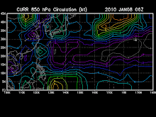
Tropical Storm NEPARTAK [21W] has accelerated NNW to Northward across the Western Pacific Ocean, south of Japan...currently located near 21.8 N lat 141.8 E Lon...about 335 km South of Iwo To. With maximum sustained winds of 65 kph near the center. This storm is not a threat to any land areas at this time.
- Typhoon2000.com
* Data as of 2009-10-10 06:00 UTC / 14:00 HKT
* 21.4N 142.0E (2868 km E of Hong Kong; 382 km S of Iwo jima, Japan), based on VIS imageries,
* Moving N at 9 km/h over the past 6 hours
* 65 gusting 90 km/h (35G50KT)
* 996 hPa
* T2.5/2.5/D0.5/24HRS (11/0530Z)
* Convection wrapped .40 on log10 spiral.
* Tropical Depression NEPARTAK has strengthened into a Tropical Storm.
* NEPARTAK is a small system, convective activities are mostly found over the northeastern quadrant. Recently a region of small deep convection is forming over the centre.
* QUIKSCAT pass also showed stronger winds to the east of NEPARTAK's centre.
* Poleward outflow is strong. As vertical wind shear remains weak, the system should develop slowly in the next day.
* At 08:11 UTC / 16:11 HKT / 17:11 JST, Iwo jima (Japan) reported a sea level pressure of 1010 hPa.
* We expect NEPARTAK to move northward slowly in general within the next 24 hours under the influence of the Pacific high.
* Members of the public in Iwo jima: NEPARTAK is approaching from the south. Please pay attention to the latest weather information from your local weather office.
* Forecast position at 11/06Z: 23.4N 141.8E, 85 km/h (45 kt)
- Pacific Tropical Cyclone Center


No comments:
Post a Comment