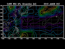
As of 12:00 p.m.,Tropical Storm NEPARTAK [21W] maintaining its slow Northward trek across the Western Pacific Ocean, south of Japan.
-Typhoon2000.com
* Data as of 2009-10-09 12:00 UTC / 20:00 HKT
* 20.0N 142.5E (2943 km E of Hong Kong; 545 km SSE of Iwo jima, Japan), based on SWIR imageries,
* Moving N at 8 km/h over the past 6 hours
* 55 gusting 90 km/h (30G50KT)
* 998 hPa
* T2.0/2.0/D1.0/24HRS (09/1130Z)
* Convection wraps .30 on log10 spiral.
* Tropical Disturbance 21W has strengthened into a Tropical Depression. It was named NEPARTAK by RSMC Tokyo which upgrade the depression to a TS.
* QUIKSCAT pass revealed that winds are much stronger over the northwestern and northeastern portion of the circulation.
* Convective activities are also limited to these 2 quadrants.
* Poleward outflow is strong. As vertical wind shear remains weak, the system should slowly develop into a Tropical Storm in the next day.
* At 14 UTC / 22 HKT / 23 JST, Iwo jima (Japan) reported a sea level pressure of 1011 hPa.
* We expect NEPARTAK to move northward slowly in general within the next 24 hours under the influences of the Pacific high.
# Forecast position at 10/11Z: 22.3N 142.4E, 75 km/h (40 kt)
- Pacific Tropical Cyclone Center


No comments:
Post a Comment