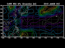
Tropical Disturbance 95W [LPA], continues to move Westward in the direction of the Southern Marianas. This system may likely become a Tropical Cyclone w/in the next 36 to 48 hours...currently located near 1at 11.3N lon 154.0E...or about 1,025 km ESE of Guam...2,070 km East of P.A.R...3,085 km East of Visayas. It has 1-min. windspeeds of 30 kph near the center. The latest (12Z Oct 24) European Forecast Guidance Model (ECMWF, European Centre for Medium-Range Weather Forecasts), which is the better and most-reliable guidance model this 2009 - shows this system heading westward (aka. "Straight-Runner") into the Philippine Sea, early next week, becoming a dangerous typhoon as it approaches Luzon, Philippines on Thursday-Friday, October 29-30 and striking Northern Bicol-NCR-Central Luzon Area on Halloween Weekend, Saturday-Sunday (Oct 31 to Nov 01). Please take note that this model changes every 12 hours, so a shift to the left or right of its future track and other conditions must be considered.
- Typhoon2000.com
SPECIAL WEATHER STATEMENT
NATIONAL WEATHER SERVICE TIYAN GU
345 PM CHST SUN OCT 25 2009
GUZ001>004-PMZ151>154-260700-
GUAM-ROTA-TINIAN-SAIPAN-MARIANAS COASTAL WATERS-
345 PM CHST SUN OCT 25 2009
...TROPICAL DISTURBANCE EAST-SOUTHEAST OF THE MARIANAS...
A TROPICAL DISTURBANCE CURRENTLY CENTERED ABOUT 625 MILES EAST-
SOUTHEAST OF THE MARIANAS NEAR 11N154E IS SLOWLY DEVELOPING AND MAY
INTENSIFY INTO A TROPICAL DEPRESSION IN THE NEXT 24 TO 36 HOURS.
MAXIMUM WINDS NEAR THE CENTER...BASED ON SATELLITE DATA...ARE
ESTIMATED TO BE 20 TO 25 MPH.
THIS DISTURBANCE IS EXPECTED TO MOVE WEST-NORTHWEST OVER THE NEXT
FEW DAYS TOWARD THE SOUTHERN MARIANAS...WITH THE LATEST MODEL
GUIDANCE BRINGING THE CENTER JUST SOUTH OF GUAM ON TUESDAY.
SINCE OCTOBER IS ONE OF THE PEAK MONTHS FOR TROPICAL CYCLONES IN
MICRONESIA...RESIDENTS OF THE MARIANAS SHOULD CLOSELY MONITOR THIS
DISTURBANCE OVER THE NEXT COUPLE OF DAYS. WEAK DISTURBANCES CAN
QUICKLY INTENSIFY THIS TIME OF YEAR IN THIS PART OF THE WESTERN
PACIFIC...AND WATCHES OR WARNINGS MAY HAVE TO BE ISSUED ON SHORT
NOTICE.
THE NATIONAL WEATHER SERVICE WILL UPDATE THIS INFORMATION AS NEEDED
BASED ON FORECAST INFORMATION FROM THE JOINT TYPHOON WARNING CENTER.
$$
MIDDLEBROOKE
- NWS-Guam


No comments:
Post a Comment