TROPICAL CYCLONE WATCH
A.
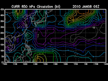
New Tropical Disturbance 92W (LPA) forming over the Philippine Sea...is now located near lat 17.3N lon 129.4E...or about 745 km East of Northern Luzon...with 1-min maximum sustained winds of 30 kph...currently drifting NNW while embedded within the Monsoon Trough (ITCZ).
B.
New Tropical Disturbance 91W (LPA) forming over the Caroline Islands...is now located near lat 8.4N lon 140.0E...or about 1,505 km East of Northern Mindanao or 240 km SE of Yap Island...with 1-min maximum sustained winds of 30 kph...currently drifting WNW slowly and is currently embedded within the eastern extent of the Monsoon Trough (ITCZ).
These systems will be closely monitored for possible development into Significant Tropical Cyclones within the next 2 to 3 days. Kindly click the cool T2K Graphical Satellite Analysis, issued everyday @ 2 PM PST (06 GMT) on tropical systems across the Western Pacific.


No comments:
Post a Comment