25W (UNNAMED) MAX WIND SPEED PER AGENCY:
+ USA (JTWC/1-min avg): 45 km/hr
+ Japan (JMA/10-min avg): 45 km/hr
TROPICAL DEPRESSION 25W [UNNAMED]
T2K PUBLIC ADVISORY NUMBER 001
5:00 PM PST (09:00 GMT)
Tue 03 November 2009
Sources: T2K Analysis/JTWC Warning #002
# View: Advisory Archives (2004-2009)
Tropical Depression 25W (UNNAMED), newly-formed in the middle of the Western Pacific Ocean...not a threat to any major land masses...currently moving northwestward.
*This system is not a threat to the Philippines, as it is located more than a thousand miles away..
*Kindly refer to your local warnings & bulletins issued by your country's official weather agency. This advisory is intended for additional information purposes only.
+ Forecast Outlook: 25W expected to move Northward within the next 12 hours before it recurves NE-ward and dissipate.
+ Effects: 25W is a weak system and is not affecting any land areas nearby. 6-hr total rainfall amounts of 2 up to 30 mm (light rain) can be expected along the outer and inner bands...with isolated amounts of 80 mm (moderate rain) near the center of 25W. Click here to view the latest NOAA's eTRaP graphic on the storm's rainfall amount.
[Important Note: Please keep in mind that the above forecast outlook, effects, current monsoon intensity, & tropical cyclone watch changes every 6 to 12 hrs!]
Time/Date: 5:00 PM PST Sat November 07 2009
Location of Center: 21.1º N Lat 155.5º E Lon
Distance 1: 325 km (175 nm) SSE of Marcus Island
Distance 2: 1,175 km (635 nm) WNW of Wake Island
Distance 3: 1,420 km (767 nm) NW of Guam, CNMI
Distance 4: 3,395 km (1,835 nm) ENE of The Philippines
MaxWinds (1-min avg): 45 kph (25 kts) near the center
Peak Wind Gusts: 65 kph (35 kts)
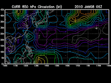
Click to view: 25W's Latest Wind Analysis
6-hr Rain Amounts (near the center): 80 mm.
Saffir-Simpson Typhoon Scale: Tropical Depression
Coastal Storm Surge Height: 0 feet [0 m]
Minimum Central Pressure: 1002 millibars (hPa)
Current Movement: NW @ 07 kph (04 kts)
Projected Area of Impact: None
Size (in Diameter): --- km (--- nm) / N/A
Max Sea Wave Height (near center): 14 ft (4.2 m)
Wunder TrackMap (for Public): 2 PM PST Sat Nov 07
JTWC Ship Avoidance TrackMap: 8 AM Tue Nov 03
TSR Wind Probabilities: Current to 2-days Ahead
NASA-JAXA TMI Page: Latest Rainrate 01
EORC-JAXA TRMM Page: Latest Rainrate 02
Zoomed Satellite Pic: Near Real-Time


No comments:
Post a Comment