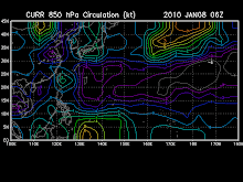
Tropical Disturbance 93W (LPA)
the area of convection previously located near 6.5n
129.5e, is now located near 6.9n 128.8e, approximately 350 nm west
of Palau. Animated multispectral satellite imagery shows improved
consolidation of the deep convection over an increasingly symmetric
low level circulation center (LLCC), as seen in the 202138z Quikscat
pass. Additionally, the 210038z trmm microwave image reveals
multiple low level bands starting to converge into the LLCC.
However, it appears the system still lacks good outflow and the deep
convection is being sheared slightly to the west. Maximum sustained
surface winds are estimated at 15 to 20 knots. Minimum sea level
pressure is estimated to be near 1005 mb. The potential for the
development of a significant tropical cyclone within the next 24
hours is upgraded to fair.
Tropical Disturbance 94W (LPA)
an area of convection has persisted near 5.9n 146.9e,
approximately 475 nm south-southeast of Guam. Animated multispectral
satellite imagery shows increasing convective consolidation over a
broad low level circulation center (LLCC). A 201958z Quikscat pass
depicts an elongated LLCC and a 202315z ascat pass indicates 20-knot
winds converging into the LLCC from the west-southwest.
Additionally, the sea level pressure at Chuuk has been around 1005
mb over the last 24 hours. The system is under the subtropical ridge
axis in an area of minimal vertical wind shear and has sufficient
radial outflow. Maximum sustained surface winds are estimated at 15
to 20 knots. Minimum sea level pressure is estimated to be near 1004
mb. The potential for the development of a significant tropical
cyclone within the next 24 hours is fair.
The following weather updates are taken from reliable weather agency and websites. Please refer to your local weather agency.
Subscribe to:
Post Comments (Atom)
You are visitor number
SEA LEVEL PRESSURE

rammb.cira.colostate.edu/projects/gparm/data/current/mtxyrpsf.gif
Check Out The NOAA's Real-Time
Tropical Cyclone Advisory
Watch A Satellite Imagery
- digital-typhoon.org
- MTSAT Tropical West Pacific Imagery
- Philippines hourly IR Image (NPMOC)
- Philippines-Micronesia Hourly IR (NWS)
- SE Asia Hourly IR Image (NPMOC)
- Tropical Floater Imagery
- WAVETRACK-Tropical Wave Tracking
- West Pacific true Color (RGB) (CIMSS, Univ. of Wisconsin)
- Western North Pacific MTSAT Satellite Derived Winds and Analysis
- www.digital-typhoon.org
Followers
Blog Archive
-
▼
2009
(334)
-
▼
November
(49)
- Typhoon NIDA (26W) still almost stationary but wit...
- NIDA (26W) downgraded to a Typhoon...still at Cate...
- Extreme Catastrophic Super Typhoon NIDA (26W)
- Powerful Super Typhoon NIDA (26W)
- Extremely Catastrophic Super Typhoon NIDA (26W)
- NIDA (26W) reaches Super Typhoon strength
- TROPICAL DEPRESSION URDUJA [27W]
- Typhoon NIDA (26W)
- Tropical Depression URDUJA (93W)
- Tropical Storm 26W (UNNAMED)
- Tropical Disturbance 93W has been upgraded to Trop...
- Tropical Depression 26W continues to gain strength
- TROPICAL DEPRESSION 26W [UNNAMED]
- Tropical Disturbance 93W raised by JMA as Tropical...
- Tropical disturbance summary: (1) the area of...
- 93W and 94W upgraded to fair and subjected to TCFA...
- Northeast Monsoon affecting Northern & Eastern Luz...
- Possible TC Formation possible over the Northweste...
- FORECAST: Based on the latest model issued b...
- I.T.C.Z. (aka. Monsoon Trough) affecting Mindanao ...
- No title
- I.T.C.Z. (aka. Monsoon Trough) affecting Visayas, ...
- Tropical Cyclone Formation is possible between Nov...
- I.T.C.Z. (aka. Monsoon Trough) affecting Eastern V...
- Tropical Disturbance 90w
- I.T.C.Z. (aka. Monsoon Trough) affecting Mindanao....
- SYPNOSIS: Intertropical ...
- Easterly Tradewinds affecting the eastern coast of...
- Easterly Tradewinds affecting the eastern coast of...
- Weather Updates
- Weather Updates
- Weather Updates
- There are no systems present across the tropical r...
- TROPICAL DEPRESSION 25W [UNNAMED]
- TROPICAL STORM 25W [UNNAMED]
- TROPICAL STORM 25W [UNNAMED]
- TROPICAL STORM 25W [UNNAMED]
- TROPICAL DEPRESSION 25W [UNNAMED]
- Easterly Tradewinds affecting the eastern coast of...
- Easterly Windflow (aka. Easterly Wave) dissipates....
- Easterly Windflow (aka. Easterly Wave) dissipates....
- Easterly Windflow (aka. Easterly Wave) bringing sc...
- Weakening Northeast Monsoon (Amihan) across Luzon....
- TROPICAL DEPRESSION TINO [24W]
- TROPICAL DEPRESSION TINO [24W]
- TROPICAL DEPRESSION TINO [97W]
- Tropical Depression 97w now develops heading towar...
- Tropical Disturbance 97W [LPA] co...
- TROPICAL STORM MIRINAE [SANTI/23W/0921]
-
▼
November
(49)

No comments:
Post a Comment