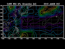
SYNOPSIS:
At 2:00 p.m. today, a Shallow Low Pressure Area (SLPA) was estimated at 590 kms East of Mindanao (07.9°N, 132.3°E). Northeast monsoon affecting Northern Luzon.
FORECAST:
Eastern Visayas and Mindanao will experience cloudy skies with scattered rainshowers and thunderstorms becoming widespread rains over Eastern Mindanao which may trigger flashfloods and landslides. Northern Luzon will have cloudy skies with scattered light rains while the rest of the country will be partly cloudy to cloudy with isolated rainshowers or thunderstorms
Moderate to strong winds blowing from the Northeast will prevail over Luzon and over the Eastern sections of Visayas and Mindanao and the coastal waters along these areas will be moderate to rough. elsewhere, winds will be light to moderate coming from the northeast with slight to moderate seas except during thunderstorms.
The following weather updates are taken from reliable weather agency and websites. Please refer to your local weather agency.
Subscribe to:
Post Comments (Atom)
You are visitor number
SEA LEVEL PRESSURE

rammb.cira.colostate.edu/projects/gparm/data/current/mtxyrpsf.gif
Check Out The NOAA's Real-Time
Tropical Cyclone Advisory
Watch A Satellite Imagery
- digital-typhoon.org
- MTSAT Tropical West Pacific Imagery
- Philippines hourly IR Image (NPMOC)
- Philippines-Micronesia Hourly IR (NWS)
- SE Asia Hourly IR Image (NPMOC)
- Tropical Floater Imagery
- WAVETRACK-Tropical Wave Tracking
- West Pacific true Color (RGB) (CIMSS, Univ. of Wisconsin)
- Western North Pacific MTSAT Satellite Derived Winds and Analysis
- www.digital-typhoon.org
Followers
Blog Archive
-
▼
2009
(334)
-
▼
November
(49)
- Typhoon NIDA (26W) still almost stationary but wit...
- NIDA (26W) downgraded to a Typhoon...still at Cate...
- Extreme Catastrophic Super Typhoon NIDA (26W)
- Powerful Super Typhoon NIDA (26W)
- Extremely Catastrophic Super Typhoon NIDA (26W)
- NIDA (26W) reaches Super Typhoon strength
- TROPICAL DEPRESSION URDUJA [27W]
- Typhoon NIDA (26W)
- Tropical Depression URDUJA (93W)
- Tropical Storm 26W (UNNAMED)
- Tropical Disturbance 93W has been upgraded to Trop...
- Tropical Depression 26W continues to gain strength
- TROPICAL DEPRESSION 26W [UNNAMED]
- Tropical Disturbance 93W raised by JMA as Tropical...
- Tropical disturbance summary: (1) the area of...
- 93W and 94W upgraded to fair and subjected to TCFA...
- Northeast Monsoon affecting Northern & Eastern Luz...
- Possible TC Formation possible over the Northweste...
- FORECAST: Based on the latest model issued b...
- I.T.C.Z. (aka. Monsoon Trough) affecting Mindanao ...
- No title
- I.T.C.Z. (aka. Monsoon Trough) affecting Visayas, ...
- Tropical Cyclone Formation is possible between Nov...
- I.T.C.Z. (aka. Monsoon Trough) affecting Eastern V...
- Tropical Disturbance 90w
- I.T.C.Z. (aka. Monsoon Trough) affecting Mindanao....
- SYPNOSIS: Intertropical ...
- Easterly Tradewinds affecting the eastern coast of...
- Easterly Tradewinds affecting the eastern coast of...
- Weather Updates
- Weather Updates
- Weather Updates
- There are no systems present across the tropical r...
- TROPICAL DEPRESSION 25W [UNNAMED]
- TROPICAL STORM 25W [UNNAMED]
- TROPICAL STORM 25W [UNNAMED]
- TROPICAL STORM 25W [UNNAMED]
- TROPICAL DEPRESSION 25W [UNNAMED]
- Easterly Tradewinds affecting the eastern coast of...
- Easterly Windflow (aka. Easterly Wave) dissipates....
- Easterly Windflow (aka. Easterly Wave) dissipates....
- Easterly Windflow (aka. Easterly Wave) bringing sc...
- Weakening Northeast Monsoon (Amihan) across Luzon....
- TROPICAL DEPRESSION TINO [24W]
- TROPICAL DEPRESSION TINO [24W]
- TROPICAL DEPRESSION TINO [97W]
- Tropical Depression 97w now develops heading towar...
- Tropical Disturbance 97W [LPA] co...
- TROPICAL STORM MIRINAE [SANTI/23W/0921]
-
▼
November
(49)

No comments:
Post a Comment