Thursday, December 31, 2009

Wishing Happy Prosperous New Year


Lets welcome the new year with joy, happiness, positive outlook in life !!!!!!!!!!!!

SYPNOSIS:


Moderate to strong Northeasterly surface windflow affecting Luzon. Tail-end of a cold front affecting Visayas.

FORECAST:


Visayas and Northern Mindanao will have cloudy skies with scattered rainshowers and thunderstorms becoming widespread rains over Visayas which may trigger flashfloods or landslides. The rest of the country will be partly cloudy to cloudy with isolated rainshowers or thunderstorms.

Moderate to strong winds blowing from the Northeast will prevail over Luzon and Visayas and coming from the East and Northeast over Eastern Mindanao and the coastal waters along these areas will be moderate to rough. Elsewhere, winds will be light to moderate blowing from the Northeast with slight to moderate seas.

Wednesday, December 30, 2009

NE Windflow across Eastern Luzon, Bicol Region & Eastern Visayas


SYPNOSIS:


Moderate to strong northeasterly surface windflow affecting Luzon. Wind convergence affecting Eastern Visayas and Mindanao.

FORECAST:


Eastern Visayas and Mindanao will have mostly cloudy skies with scattered rainshowers and thunderstorms. The rest of the country will be partly cloudy to cloudy with isolated rainshowers or thunderstorms.

Moderate to strong winds blowing from the Northeast will prevail over Luzon and Visayas and coming from the East and Northeast over Eastern Mindanao and the coastal waters along these areas will be moderate to rough. Elsewhere, winds will be light to moderate blowing from the northeast with slight to moderate seas.

Tuesday, December 29, 2009

Special Weather Outlook for the New Year Holidays


FORECAST:


Northern and Eastern Luzon will experience mostly cloudy skies with scattered light rains while Eastern Visayas and Mindanao will have mostly cloudy skies with scattered rainshowers and thunderstorms. The rest of the country will be partly cloudy to cloudy with isolated rainshowers or thunderstorms.

Moderate to strong winds blowing from the Northeast will prevail over Luzon and Visayas and coming from the East and Northeast over Eastern Mindanao and the coastal waters along these areas will be moderate to rough. Elsewhere, winds will be light to moderate blowing from the Northeast with slight to moderate seas.

Special Weather Outlook for the New Year Holidays

The tail-end of cold front is likely to still prevail over Visayas and Mindanao which will bring scattered rainshowers becoming widespread rains in the eastern section of these areas on Thursday and Friday (Dec. 31 and Jan. 01). However, rain activity will gradually shift towards Bicol region by Saturday and Sunday (Jan. 02 and 03). For the rest of the country, good weather condition with isolated or passing light rains is expected to persist throughout the outlook period. Cooler temperatures associated with the northeast monsoon (Amihan) will also continue to be experienced in the country especially in Luzon area.

Moderate to strong northeasterly winds will still prevail over Luzon and Visayas and the coastal waters along these areas will be moderate to rough. Small sea crafts and fishing vessels are advised to be alert against moderate to high waves along the seaboards of Luzon and Eastern Visayas generated by the northeastely winds.

DOST-PAGASA is providing this special weather outlook to give guidance to the public in their travel plans during the peak of the new year holidays.

This outlook will be updated as soon as significant changes in the weather occur.

For more information, please contact the forecaster-on-duty in the following telephone numbers: 927-1541/927-1335/926-4258.

Courtesy of: PAGASA

Saturday, December 26, 2009

WEATHER UPDATE

SYPNOSIS:


Cold front affecting Extreme Northern Luzon. Wind convergence affecting Eastern Mindanao.


FORECAST:


Extreme Northern Luzon will experience mostly cloudy skies with scattered light rains while Mindanao will have mostly cloudy skies with scattered rainshowers and thunderstorms. The rest of the country will be partly cloudy to cloudy with isolated rainshowers or thunderstorms.

Moderate to strong winds blowing from the Northeast will prevail over Luzon and the eastern sections of Visayas and Mindanao and the coastal waters along these areas will be moderate to rough. Elsewhere, winds will be light to moderate blowing from the Northeast with slight to moderate seas.

Friday, December 25, 2009

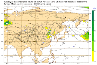
Latest ECMWF forecast to have an active system before the year ends


SYPNOSIS:


Moderate to strong Northeasterly surface windflow affecting Luzon and Visayas. Tail end of a cold front affecting Mindanao.

FORECAST:


Extreme Northern Luzon will experience mostly cloudy skies with scattered light rains while Mindanao will have mostly cloudy skies with scattered rainshowers and thunderstorms. The rest of the country will be partly cloudy to cloudy with isolated rainshowers or thunderstorms.

Moderate to strong winds blowing from the Northeast will prevail over the country and the coastal waters will be moderate to rough.

Thursday, December 24, 2009


SYPNOSIS:


Northeast monsoon affecting Luzon and Visayas. Diffused tail-end of a cold front affecting Mindanao.

FORECAST:


Luzon and Eastern Visayas will experience mostly cloudy skies with scattered light rains while Mindanao will have cloudy skies with scattered rainshowers and thunderstorms. The rest of the country will be partly cloudy to cloudy with isolated rainshowers or thunderstorms.

Moderate to strong winds blowing from the Northeast will prevail over the country and the coastal waters will be moderate to rough.

Wednesday, December 23, 2009

One or two active system might develop before the year ends


Based on the latest model issued by ECMWF, one or two active system might develop over the Pacific Ocean before the year ends. More updates as long as the model data issued by the agency remains the same.

SYPNOSIS:


Northeast monsoon affecting Luzon and Visayas. Diffused tail-end of a cold front affecting Mindanao.

FORECAST:


Luzon and Eastern Visayas will experience mostly cloudy skies with scattered light rains while Mindanao will have cloudy skies with scattered rainshowers and thunderstorms. The rest of the country will be partly cloudy to cloudy with isolated rainshowers or thunderstorms.

Moderate to strong winds blowing from the Northeast will prevail over Luzon, Visayas and Eastern Mindanao and the coastal waters along these areas will be moderate to rough. Elsewhere, winds will be light to moderate coming from the Northeast with slight to moderate seas.

Tuesday, December 22, 2009

Tropical Cyclone Formation is not expected through Christmas Day, December 25, 2009


SYPNOSIS:


Northeast monsoon associated with moderate to strong northeasterly windflow affecting Luzon and Visayas. Diffused tail-end of a cold front affecting Mindanao.

FORECAST:


Luzon and Eastern Visayas will experience mostly cloudy skies with scattered light rains while Mindanao will have cloudy skies with scattered rainshowers and thunderstorms. The rest of the country will be partly cloudy to cloudy with isolated rainshowers or thunderstorms.

Moderate to strong winds blowing from the Northeast will prevail over Luzon, Visayas and Eastern Mindanao and the coastal waters along these areas will be moderate to rough. Elsewhere, winds will be light to moderate coming from the Northeast with slight to moderate seas except during thunderstorms.

Monday, December 21, 2009

WEATHER UPDATE

SYPNOSIS:


Diffused tail-end of a cold front affecting Eastern Mindanao. Northeast monsoon affecting Luzon and Visayas.

FORECAST:


Luzon and Eastern Visayas will experience mostly cloudy skies with scattered light rains while Mindanao will have mostly cloudy skies with scattered rainshowers and isolated thunderstorms. The rest of the country will be partly cloudy to cloudy with isolated rainshowers or thunderstorms.

Moderate to strong winds blowing from the Northeast will prevail over Luzon, Visayas and Eastern Mindanao and the coastal waters along these areas will be moderate to rough. Elsewhere, winds will be light to moderate coming from the Northeast with slight to moderate seas except during thunderstorms.

Sunday, December 20, 2009

WEATHER UPDATE

SYPNOSIS:


Diffused tail-end of a cold front affecting Eastern Mindanao. Moderate to strong Northeasterly surface windflow prevailing over Luzon, Visayas and Eastern Mindanao.

FORECAST:


Northern Luzon and the Eastern Visayas will experience mostly cloudy skies with scattered light rains. Eastern Mindanao will have mostly cloudy skies with scattered rainshowers and isolated thunderstorms. The rest of the country will be partly cloudy to cloudy with isolated rainshowers or thunderstorms.

Moderate to strong winds blowing from the Northeast will prevail over Luzon, Visayas and Eastern Mindanao and the coastal waters along these areas will be moderate to rough. Elsewhere, winds will be light to moderate coming from the Northeast with slight to moderate seas except during thunderstorms.

Wednesday, December 16, 2009


Tropical Disturbance 91W now upgraded to fair


DISCUSSION:

An area of convection has persisted near 6.0n 178.9e,
approximately 675 nm east-southeast of kwajalein. Recent animated
multispectral satellite imagery shows low level cloud lines wrapping
cyclonically beneath a small, but persistent area of symmetric deep
convection. A 151712z ssmis microwave image reveals weak to moderate
banding associated with a well-defined low level circulation center
that is easily identifiable in 37h as a small eye-like feature.
Upper level analysis indicates low to moderate vertical wind shear
and favorable venting to the north and south of the circulation.
Maximum sustained surface winds are estimated at 10 to 15 knots.
Minimum sea level pressure is estimated to be near 1007 mb. The
potential for the development of a significant tropical cyclone
within the next 24 hours is fair.

Tuesday, December 15, 2009

Tropical Cyclone Formation is possible before Christmas near the area of Guam.


Based on the latest numerical data,active system will develop before the Christmas season tracking WNW to NW direction.More data will be issued once the other numerical weather guidance and agency will similar to the progress of the forecast system.

* Prior to change unless the numerical weather data will remain the same.

Monday, December 14, 2009

Weather Update

SYPNOSIS:


Diffused tail-end of a cold front affecting Eastern Visayas.

FORECAST:


Southern Luzon and the whole Visayas will experience mostly cloudy skies with scattered rainshowers and isolated thunderstorms. The rest of the country will be partly cloudy to cloudy with isolated rainshowers or thunderstorms.

Moderate to strong winds blowing from the Northeast will prevail over Northern and Eastern Luzon and over the whole Visayas and coming from the Northeast and East over Eastern Mindanao and the coastal waters along these areas will be moderate to rough. Elsewhere, winds will be light to moderate coming from the Northeast with slight to moderate seas except during thunderstorms.

Friday, December 11, 2009

ECMWF Forecasts to have a 1 active system on Dec.17-21,2009


Based on the latest model issued, there is a possibility that one active system will develop between Dec.18-21,2009. It is forecast to moved and the potential track area might be the Visayas and Northern Mindanao.

* Prior to change unless if the numerical data on the next issue will remain the same.

Weakening Tail-end of a Cold Front affecting Eastern Luzon

SYPNOSIS:


At 2 p.m. today, a Low Pressure Area (LPA) was estimated based on satellite and surface data at 860 kms East of Mindanao (7.0°N 135.0°E). Tail end of a cold front affecting the Eastern section of Northern and Central Luzon.


FORECAST:


The Eastern section of Luzon and Visayas and whole of Mindanao will experience cloudy skies with scattered rainshowers and isolated thunderstorms. The rest of the country will have partly cloudy to cloudy skies with isolated rainshowers or thunderstorms.

Moderate to strong winds blowing from the Northeast will prevail over Luzon, Visayas and Eastern Mindanao and the coastal waters along these areas will be moderate to rough. Elsewhere, winds will be light to moderate blowing from the Northeast to North with slight to moderate seas except during thunderstorms.

Wednesday, December 9, 2009

Northeast Monsoon affecting Eastern Luzon & Bicol...becoming more rainy over Catanduanes and Coastal Camarines & Albay.

SYPNOSIS:


At 2:00 p.m. today, a Low Pressure Area (LPA) was estimated in the vicinity of Tagbiliran City (09.7°N, 123.9°E). Northeast monsoon affecting Northern and Eastern Luzon.


FORECAST:


Southern Luzon and Visayas will experience cloudy skies with scattered rainshowers and thunderstorms. The rest of the country will be partly cloudy to cloudy with isolated rainshowers or thunderstorms.

Moderate to strong winds blowing from the Northeast will prevail over Luzon and Visayas, and coming from the Northeast to Northwest over Eastern Mindanao and the coastal waters along these areas will be moderate to rough. Elsewhere, winds will be light to moderate coming from the Northeast to Northwest with slight to moderate seas except during thunderstorms.
(in Filipino)

Tuesday, December 8, 2009

Tropical Disturbance 90w now weakening


As of 5 p.m.

Weakening LPA (90W/1006 MB) moved SW-ward closer to the coast of Surigao
or near 9.4N 127.6E...about 235 km ESE of Surigao City

SYPNOSIS:

Northeast Monsoon affecting Eastern Luzon, Bicol and Samar...bringing windy and cloudy condition w/ possible passing drizzle or light rains. LPA (90W) bringing widespread rains across Visayas and Northern Mindanao.

Monday, December 7, 2009

Tropical Disturbance 90w rapidly intensifying near the eastern coast of samar within the next 12-24 hours. (JMA raised it as TD)


As of 1 a.m.

Strong LPA (90W/1005 MB) rapidly developing off the Philippine Sea, east of Samar
or near 11.1N 128.3E...about 320 km ESE of Borongan, E.Samar

Discussion:

the area of convection previously located near 11.2n
129.1e, is now located near 10.9n 128.5e, approximately 490 nm east-
southeast of Manila, Philippines. Animated multispectral satellite
imagery shows a defined low level circulation center (LLCC) with
rapidly weakening convection. However, a 072312z ssmis image depicts
a symmetric LLCC with curved low-level banding wrapping into the
center. An ascat pass showed 15 to 20 knot winds along the
northwestern quadrant of the LLCC, with weaker 10 to 15 knot winds
wrapping into the LLCC along the southeastern quadrant. Upper-level
analysis indicates that the LLCC is located south of the ridge axis
under northeasterly flow. Maximum sustained surface winds are
estimated at 15 to 20 knots. Minimum sea level pressure is estimated
to be near 1006 mb. Based on the defined LLCC, the potential for the
development of a significant tropical cyclone within the next 24
hours is upgraded to good. See ref a (wtpn21 pgtw 072330) for
further details.

Tropical Cyclone Formation is possible next week between Dec.14-18,2009


Based on the latest weather forecast model issued by the year's most reliable weather agency, ECMWF new system might develop early next week due to its favorable environment condition. More models will be issued if this system will develop into a new and active TC.

SYPNOSIS:


Northeast Monsoon affecting Luzon and Visayas.


FORECAST:


Luzon and Visayas will experience partly cloudy to cloudy skies with light rains. Mindanao will have partly cloudy to cloudy skies with isolated rainshowers or thunderstorms.

Moderate to strong winds blowing from the Northeast will prevail over Luzon and Visayas, and coming from the Northwest over Eastern Mindanao. The coastal waters along these areas will be moderate to rough. Elsewhere, light to moderate Northeasterly to Northwesterly winds will prevail with slight to moderate seas except during thunderstorms.

Sunday, December 6, 2009

WEATHER UPDATE

SYPNOSIS:


Northeast Monsoon affecting Luzon and Visayas.

FORECAST:


Luzon and Visayas will experience partly cloudy to cloudy skies with light rains. Mindanao will have partly cloudy to cloudy skies with isolated rainshowers or thunderstorms.

Moderate to strong winds blowing from the Northeast will prevail over Luzon and Visayas, and coming from the Northwest over Eastern Mindanao. The coastal waters along these areas will be moderate to rough. Elsewhere, light to moderate Northeasterly to Northwesterly winds will prevail with slight to moderate seas except during thunderstorms.

Friday, December 4, 2009

Tropical Storm 28w (Twenty-eight) now develops heading Iwo To


At 050000z, tropical storm 28w (twentyeight) was located
near 23.4n 144.6e, approximately 195 nm east-southeast of iwo to,
and had tracked east-northeastward at 18 knots over the past six
hours. Maximum sustained surface winds were estimated at 35 knots
gusting to 45 knots. See ref a (wtpn31 pgtw 050300) for the final
warning on this system.

Advisory:

816

wtpn31 pgtw 050300
msgid/genadmin/navmarfcstcen Pearl Harbor hi/jtwc//
subj/tropical cyclone warning//
rmks/
1. Tropical storm 28w (twentyeigh) warning nr 001
upgraded from tropical depression 28w
01 active tropical cyclone in northwestpac
Max sustained winds based on one-minute average
wind radii valid over open water only
---
warning position:
050000z --- near 23.4n 144.6e
movement past six hours - 065 degrees at 18 kts
position accurate to within 060 nm
position based on center located by satellite
present wind distribution:
Max sustained winds - 035 kt, gusts 045 kt
wind radii valid over open water only
becoming extratropical
repeat posit: 23.4n 144.6e
---
forecasts:
12 hrs, valid at:
051200z --- 26.0n 147.4e
Max sustained winds - 035 kt, gusts 045 kt
wind radii valid over open water only
extratropical
vector to 24 hr posit: 050 deg/ 24 kts
---
24 hrs, valid at:
060000z --- 28.9n 151.8e
Max sustained winds - 035 kt, gusts 045 kt
wind radii valid over open water only
extratropical
---
remarks:
050300z position near 24.1n 145.3e.
Tropical Storm (TS) 28w (twentyeight), located approximately 195 nm
east-southeast of iwo to, has tracked east-northeastward at 18 knots
over the past six hours. Over the last 12 hours, animated infrared
and multispectral satellite imagery show sustained deep convection
near the low level circulation center (LLCC) despite vertical wind
shear in excess of 30 knots. Additionally, a 042039z SSMI microwave
image shows improved wrapping into the system center as well as a
symmetric LLCC. Recent AMSU cross sections also depict the continued
presence of a warm core. At 040000z, Dvorak estimates from pgtw have
come up to 35 knots and knes reported an estimate of 35 knots at
041500z. Ts 28w is currently also showing signs of beginning an
extratropical transition. The warm anomalies in the AMSU cross
sections have dropped from two degrees at 040900z to one degree at
041600z. Additionally, the greatest extent of deep convection has
shifted to the northeast of the system center and total precipitable
water (tpw) products show the intrusion of dry air from the west-
southwest as well as an encroaching frontal zone located to the
northwest. Ts 28w should complete its transition into a baroclinic
system over the next 12 hours as it tracks under increasingly
unfavorable vertical wind shear, over sea surface temperatures less
than 26 degrees celcius, and the inflow of cooler, drier air breaks
down the warm core aloft. This is the final warning on this system
by the Joint Typhoon Warning Center (navmarfcstcen). The system will
be closely monitored for signs of regeneration. Maximum significant
wave height at 050000z is 12 feet.//

You are visitor number

SEA LEVEL PRESSURE

SEA LEVEL PRESSURE
rammb.cira.colostate.edu/projects/gparm/data/current/mtxyrpsf.gif

Followers