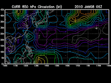

As of 1 a.m.
Strong LPA (90W/1005 MB) rapidly developing off the Philippine Sea, east of Samar
or near 11.1N 128.3E...about 320 km ESE of Borongan, E.Samar
Discussion:
the area of convection previously located near 11.2n
129.1e, is now located near 10.9n 128.5e, approximately 490 nm east-
southeast of Manila, Philippines. Animated multispectral satellite
imagery shows a defined low level circulation center (LLCC) with
rapidly weakening convection. However, a 072312z ssmis image depicts
a symmetric LLCC with curved low-level banding wrapping into the
center. An ascat pass showed 15 to 20 knot winds along the
northwestern quadrant of the LLCC, with weaker 10 to 15 knot winds
wrapping into the LLCC along the southeastern quadrant. Upper-level
analysis indicates that the LLCC is located south of the ridge axis
under northeasterly flow. Maximum sustained surface winds are
estimated at 15 to 20 knots. Minimum sea level pressure is estimated
to be near 1006 mb. Based on the defined LLCC, the potential for the
development of a significant tropical cyclone within the next 24
hours is upgraded to good. See ref a (wtpn21 pgtw 072330) for
further details.


No comments:
Post a Comment