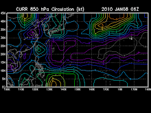
DISCUSSION:
An area of convection has persisted near 6.0n 178.9e,
approximately 675 nm east-southeast of kwajalein. Recent animated
multispectral satellite imagery shows low level cloud lines wrapping
cyclonically beneath a small, but persistent area of symmetric deep
convection. A 151712z ssmis microwave image reveals weak to moderate
banding associated with a well-defined low level circulation center
that is easily identifiable in 37h as a small eye-like feature.
Upper level analysis indicates low to moderate vertical wind shear
and favorable venting to the north and south of the circulation.
Maximum sustained surface winds are estimated at 10 to 15 knots.
Minimum sea level pressure is estimated to be near 1007 mb. The
potential for the development of a significant tropical cyclone
within the next 24 hours is fair.


No comments:
Post a Comment