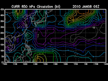
the area of convection previously located near 9.2n
148.5e, is now located near 10.4n 147.1e, approximately 235 nm
southeast of Guam. Recent animated multispectral satellite imagery
and a 020352z amsub microwave pass reveal weak low level cyclonic
turning to the southeast of Guam. Interrogation of the Guam radar,
more specifically the base velocity product, shows predominately
convergent easterlies corresponding to the deepest, sustained
convection over Guam, with evidence of weak cyclonic turning to the
southeast. A partial 020028z ascat pass also confirms a broad
circulation, with sustained winds possibly as high as 20 knots. As
of 020200z, sea level pressure at Guam was 1005 mb (2 mb 24-hour
pressure fall) and winds were out of the northeast at 15 knots. The
disturbance lies in close proximity to the upper level ridge axis,
which is providing low vertical wind shear and favorable (poleward)
venting. Maximum sustained surface winds are estimated at 15 to 20
knots. Minimum sea level pressure is estimated to be near 1004 mb.
The potential for the development of a significant tropical cyclone
within the next 24 hours is upgraded to fair due to the sea level
pressure trend at Guam, and evidence of a formative low level
circulation center within a mostly favorable environment.


No comments:
Post a Comment