SYPNOSIS:
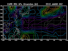
At 2 p.m. today, a Low Pressure Area (LPA) was estimated based on satellite and surface data at 860 kms East of Mindanao (7.0°N 135.0°E). Tail end of a cold front affecting the Eastern section of Northern and Central Luzon.
FORECAST:
The Eastern section of Luzon and Visayas and whole of Mindanao will experience cloudy skies with scattered rainshowers and isolated thunderstorms. The rest of the country will have partly cloudy to cloudy skies with isolated rainshowers or thunderstorms.
Moderate to strong winds blowing from the Northeast will prevail over Luzon, Visayas and Eastern Mindanao and the coastal waters along these areas will be moderate to rough. Elsewhere, winds will be light to moderate blowing from the Northeast to North with slight to moderate seas except during thunderstorms.
The following weather updates are taken from reliable weather agency and websites. Please refer to your local weather agency.
Subscribe to:
Post Comments (Atom)
You are visitor number
SEA LEVEL PRESSURE

rammb.cira.colostate.edu/projects/gparm/data/current/mtxyrpsf.gif
Check Out The NOAA's Real-Time
Tropical Cyclone Advisory
Watch A Satellite Imagery
- digital-typhoon.org
- MTSAT Tropical West Pacific Imagery
- Philippines hourly IR Image (NPMOC)
- Philippines-Micronesia Hourly IR (NWS)
- SE Asia Hourly IR Image (NPMOC)
- Tropical Floater Imagery
- WAVETRACK-Tropical Wave Tracking
- West Pacific true Color (RGB) (CIMSS, Univ. of Wisconsin)
- Western North Pacific MTSAT Satellite Derived Winds and Analysis
- www.digital-typhoon.org
Followers
Blog Archive
-
▼
2009
(334)
-
▼
December
(31)
- Wishing Happy Prosperous New Year
- NE Windflow across Eastern Luzon, Bicol Region & E...
- Special Weather Outlook for the New Year Holidays
- No title
- Weather Update
- WEATHER UPDATE
- Latest ECMWF forecast to have an active system bef...
- No title
- One or two active system might develop before the ...
- Tropical Cyclone Formation is not expected through...
- WEATHER UPDATE
- WEATHER UPDATE
- No title
- Tropical Disturbance 91W now upgraded to fair
- Tropical Cyclone Formation is possible before Chri...
- Weather Update
- ECMWF shows two possible active TC next week.
- ECMWF Forecasts to have a 1 active system on Dec.1...
- Weakening Tail-end of a Cold Front affecting Easte...
- Northeast Monsoon affecting Eastern Luzon & Bicol....
- Tropical Disturbance 90w now weakening
- Tropical Disturbance 90w rapidly intensifying near...
- Tropical Cyclone Formation is possible next week b...
- WEATHER UPDATE
- Tropical Storm 28w (Twenty-eight) now develops hea...
- Tropical Disturbance 97W (LPA) has started losi...
- NIDA (VINTA) weakens into a weak Tropical Depressi...
- Tropical Disturbance 97W is now upgraded to fair.
- Typhoon NIDA is now being sheared off as strong NE...
- Typhoon NIDA continues to weaken as it moves slowl...
- Typhoon NIDA continues to weaken as it moves slowl...
-
▼
December
(31)

No comments:
Post a Comment