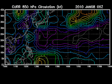
Tropical Disturbance 91W (LPA) on the verge of becoming a Tropical Depression (TD) as it accelerated westward closer to the Bicol Region...currently located near lat 12.8 lon 127.7E...or about 380 km ESE of Virac, Catanduanes...with 1-min maximum sustained winds of 40 kph...forecast to move West to WNW @ 15 kph.
This system is likely to develop into a Tropical Cyclone within the next 06 to 12 hours. It is then expected to bring scattered widespread rains across portions of Luzon, Metro Manila and Visayas tonight and tomorrow - becoming more frequent over the Bicol Region. Kindly click the cool T2K Graphical Satellite Analysis, issued everyday @ 2 PM PST (06 GMT) on tropical systems across the Western Pacific.


No comments:
Post a Comment